


Neel Fire Dept, Morgan County, Alabama
About
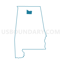
Outline

Summary
| Unique Area Identifier | 522739 |
| Name | Neel Fire Dept |
| County | Morgan County |
| State | Alabama |
| Area (square miles) | 23.67 |
| Land Area (square miles) | 23.36 |
| Water Area (square miles) | 0.31 |
| % of Land Area | 98.67 |
| % of Water Area | 1.33 |
| Latitude of the Internal Point | 34.47556090 |
| Longtitude of the Internal Point | -87.04430350 |
Maps


Graphs
Select a template below for downloading or customizing gragh for Neel Fire Dept, Morgan County, Alabama


Neighbors
Neighoring Voting District (by Name) Neighboring Voting District on the Map
- American Legion Bldg, Morgan County, AL
- Danville Volunteer Fire Station, Morgan County, AL
- Decatur Fire and Rescue- 4119 Old Highway 31, Morgan County, AL
- John J Sparkman Civic Center, Morgan County, AL
- Kitchens Mill Masonic Hall A, Lawrence County, AL
- Speake Vol Fire Dept, Lawrence County, AL
- West Morgan/ East Law. Water Authority, Morgan County, AL
Top 10 Neighboring County Subdivision (by Population) Neighboring County Subdivision on the Map
- Decatur CCD, Morgan County, AL (61,269)
- Hartselle CCD, Morgan County, AL (20,946)
- Morris Chapel CCD, Lawrence County, AL (11,552)
- Danville CCD, Morgan County, AL (6,530)
- Speake-Oakville CCD, Lawrence County, AL (2,124)
Top 10 Neighboring Place (by Population) Neighboring Place on the Map
Top 10 Neighboring Unified School District (by Population) Neighboring Unified School District on the Map
- Morgan County School District, AL (50,012)
- Lawrence County School District, AL (34,339)
- Hartselle City School District, AL (13,879)
Top 10 Neighboring State Legislative District Lower Chamber (by Population) Neighboring State Legislative District Lower Chamber on the Map
- State House District 4, AL (51,181)
- State House District 9, AL (45,371)
- State House District 7, AL (40,956)
Top 10 Neighboring State Legislative District Upper Chamber (by Population) Neighboring State Legislative District Upper Chamber on the Map
Top 10 Neighboring 111th Congressional District (by Population) Neighboring 111th Congressional District on the Map
Top 10 Neighboring Census Tract (by Population) Neighboring Census Tract on the Map
- Census Tract 52, Morgan County, AL (6,530)
- Census Tract 9796, Lawrence County, AL (5,481)
- Census Tract 51.07, Morgan County, AL (4,353)
- Census Tract 53.02, Morgan County, AL (3,481)
- Census Tract 9797, Lawrence County, AL (2,124)
- Census Tract 51.05, Morgan County, AL (2,014)
- Census Tract 51.03, Morgan County, AL (875)